
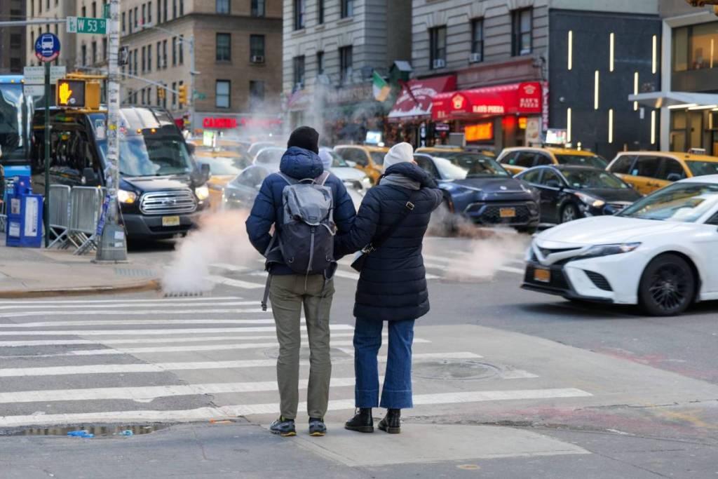

It looks like our fall sweaters will finally be getting some well-deserved wear!
After weeks of unpredictable weather, a sharp cold front is settling over the tri-state area this weekend. The incoming system is delivering New York City’s first genuine cold streak of the season alongside some classic autumn weather mood swings.
If there is one thing New Yorkers know about local fall weather, it is that the city can rarely make up its mind. Warm, mild air will stick around through midweek before a steep temperature drop reminds everyone that winter isn’t too far behind.
Mild Warmth Dominates Midweek Before Rain Arrives
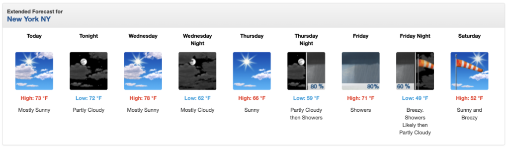
Before the cold air sweeps in, the city will experience a final stretch of early-autumn warmth. According to the National Weather Service (NWS), temperatures in Central Park will soar near 78°F on Wednesday under mostly sunny skies. Thursday will offer pleasant conditions in the mid-60s, serving as a gentle bridge into the transition ahead.
The shift begins late Thursday night into Friday. According to NWS forecasts, a dynamic frontal boundary will bring an 80% chance of showers through Friday evening, accompanied by breezy winds and a distinct shift in air mass.
Weekend Chill Drops Temperatures into the 40s
Once the rain moves out on Friday night, the cold front will fully take hold across Manhattan and the surrounding boroughs. According to the NWS, nighttime temperatures Friday will plummet to 49°F as strong northwest winds develop.
Saturday will bring the crispest air the region has seen since spring:
- Saturday Daytime: Highs will top out at just 52°F with clear, sunny skies and blustery winds.
- Saturday Night: Clear skies and weakening winds will allow temperatures to drop to a chilly 43°F overnight in the city, with suburban areas and higher elevations north and west dipping into the 30s.
- Sunday: Expect a sunny but cool end to the weekend, with high temperatures hovering near 56°F.
What to Expect Beyond the Weekend
The chill will mark a temporary bottom for the autumn transition.
According to the NWS extended outlook, the airmass will slowly moderate heading into early next week, with daytime highs returning to the low-to-mid 60s by Monday. For now, keep your jackets and heavy layers near the front of the closet—you will definitely need them when stepping outside this weekend.
Don’t miss out! Follow us on Facebook, Instagram, and now on WhatsApp, too!