
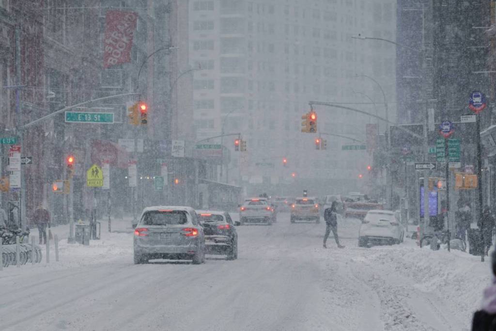

Maybe it’ll be time to pull out those snow boots sooner than any New Yorker could have expected. A major change in this week’s weather has taken shape today. A potential nor’easter could impact the Northeast and New England before leaving us with a cold blast to be felt by the rest of the country.
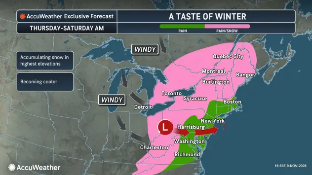
The colder drops in temperature for this week are already paving the way for a weather formation that could bring us rain, strong winds and possibly even a first snowfall. This developing system is tracking to take place Thursday November 12 through Saturday November 14.
AccuWeather is reporting that a strong ridge is developing over the western United States, allowing colder Canadian air to push south into the Northeast as warmer air builds across the West. This contrast in air masses, combined with upper-level energy, will help strengthen an area of low pressure and set the stage for a late-week storm.
What’s a nor’easter?
According to the National Weather Service,
A Nor’easter is a storm along the East Coast of North America, so called because the winds over the coastal area are typically from the northeast. These storms may occur at any time of year but are most frequent and most violent between September and April.
Nor’easters almost always bring precipitation in the form of heavy rain or snow, as well as winds of strong force, rough seas, and, occasionally, some coastal flooding to the affected regions within the northeast. The regions most affected are usually between the Washington D.C., Philadelphia, New York and Boston areas; also known as the “I-95 Corridor.”
The potential of it reaching nor’easter status
With the storm still days away, there remains some uncertainty about whether it will develop into a powerful nor’easter.
One possible scenario involves an initial area of low pressure moving inland through the Ohio Valley and eastern Great Lakes before changing its energy offshore, where a secondary coastal low could develop.
If this scenario occurs, the immediate coastline and I-95 corridor would likely see limited precipitation, whereas farther inland could see enough moisture to create snowfall.
In the second scenario being tracked, the models are anticipating the nor’easter to attach itself closer to the Eastern Seaboard. The storm would then develop much closer to the coast, which would shift the heavy precipitation and strong winds to the coastline.
What to expect day by day this week?
According to AccuWeather, the system will be formed as it migrates early in the week over the Great Lakes and Ohio Valley. During this period, the developing system will still be relatively weak and likely only cause scattered rainstorms with limited impact.
Come Thursday, the system will advance towards the Northeast causing mostly rain. Scattered showers could reach the I-95 Corridor and create some travel delays, but impacts appear to still be limited in scope.
By Friday, the storm will start to strengthen and move closer to the coast. The most successful chances for snowfall will be in areas like Maine, Vermont, New Hampshire and New York.
Whether a secondary coastal low develops will influence precipitation amounts on Saturday across several areas. If the low fails to develop near the Mid-Atlantic, precipitation along the I-95 corridor would likely remain limited.
If the secondary coastal low forms farther south, then the coastal corridor would likely face strong winds and the potential for the rain to transition into snow.
With the storm approaching later this week, the exact impact on New York City remains uncertain. However, precipitation is expected so stay tuned and be prepared.
Don’t miss out! Follow us on Facebook, Instagram, and now on WhatsApp, too!